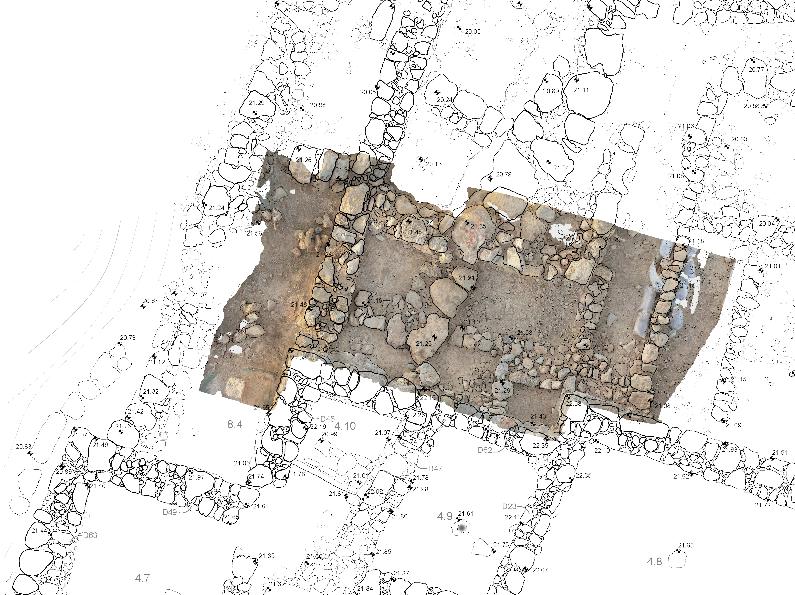
Fig. 1: Tracing orthophotos © Nikolia Kartalou
The architectural survey of the Sissi Archaeological Project has been conducted over multiple years by different teams of architects employing a range of methodologies. Since 2022, the architectural documentation has been carried out by Dr Nikolia Kartalou, continuing and further developing the digital methodology established in earlier years by Eleftheria Zografou.
Survey Phases
The initial architectural survey took place in 2013 under the direction of Aphroditi Chalkidi, assisted by Marianna Nassi and Vassiliki Gouliopoulou. This phase focused on documenting the northeast, southwest, and southeast parts of the ceremonial Building F in Zone 6, as well as the surrounding areas of the central court.
In 2016, Eleftheria Zografou, together with Marilena Pateraki and Christos Koutsaftis, introduced a digital methodology based on close-range photogrammetry. Their work concentrated on the east part of Building CD in Zones 4 and 13, as well as the southern part of the building in Zone 9.
Zografou continued to lead the survey until 2021, during which she was joined by Dr Konstantinos Athanasiou and Dr Nikolia Kartalou to record changes in Zones 9, 18, and 8, along with areas around the central court in Zones 5, 6, 10, 16, and 17.
In 2022, Kartalou took over as the lead architect responsible for the architectural survey of the site, continuing the documentation of Zone 16 and recording new findings from the excavation of Zone 7. In 2024, she expanded the survey to include the Prepalatial area of Zone 10, recording structures and features revealed during the 2023 and 2024 excavation campaigns.
Survey Method
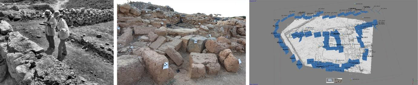
Figs. 2, 3, 4 (from left to right): E. Zografou and M. Pateraki detecting changes in-situ; Control Points in-situ; Digital model in Agisoft Photoscan © Elefteria Zografou
First introduced by Eleftheria Zografou in 2016, close-range photogrammetry has proven to be an effective and reliable method for the architectural documentation of the remains and has remained a core practice ever since. During the documentation process, high-resolution DSLR cameras are employed to capture multiple overlapping images from a variety of angles, ensuring comprehensive coverage of the structures. Particular attention is paid to lighting conditions in order to minimise shadows, which could interfere with the software’s ability to accurately identify and match common points across images.
All surveys have been conducted with the invaluable and ongoing collaboration of topographer Nicolas Kress, whose precise measurements facilitate the georeferencing of the digital models. Survey targets are strategically placed on key measured points of the architectural features and accurately recorded by Kress to establish reliable control points for georeferencing the model. The processing is carried out using Agisoft Photoscan Professional software, which allows complex structures to be segmented into smaller, more manageable components –optimising computing time and improving workflow efficiency.
This method facilitates the timely production of orthophotos, which can be reviewed on site to verify data accuracy and, if necessary, guide the acquisition of additional images before proceeding with the final drafting of architectural plans and elevations. Once verified, the orthophotos are imported into CAD software, where they serve as the foundational layer for producing accurate digital drawings of the surveyed areas, often completed ex situ.
Nikolia Kartalou
University of Edinburgh
Image Credits
Fig. 1: Tracing orthophotos © Nikolia Kartalou
Figs. 2, 3, 4 (from left to right): E. Zografou and M. Pateraki detecting changes in-situ; Control Points in-situ; Digital model in Agisoft Photoscan © Elefteria Zografou